[edit]1.5. Introduction to CMBox software, data formats and GIS.
[edit]CMBox software
The core CM Box software (AgrometShell) can be downloaded free of charge from here. A list of all AgrometShell functions and their help files (also integrated into AMS) is available as well.
A number of other software packages are recommended when applying CM Box methods:
- Windisp. Display and analysis of satellite imagery.
- Word and Excel (or their open source cousins).
- LocClim (Local Climate Generator).
- GIS software (optional).
[edit]Data types used in crop forecasting.
Over the years, crop forecasting has developed its own file type standards. This has developed over the years, mainly because low-cost GIS systems with their data types did not exist at the time most early warning systems were set up. The most important file types are:
- Image data in IDA (Image Display and Analysis) format. The IDA image file consists of a 512 byte image header followed by unblocked (raw binary) image data, 1 byte per pixel, beginning at the top-left of the image and processing row by row. This means that the size of an IDA image in bytes can be expressed as 512 + (lines*pixels). An image that is 150 lines high and 234 pixels wide will have an image size of 35612 bytes. This provides an excellent check whenever images seem to be distorted. A more detailed description of the IDA image format. Display an IDA image in Agrometshell using the View-Image function.
Specifying the image file 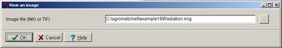
Displaying the image in the Agrometshell Viewer 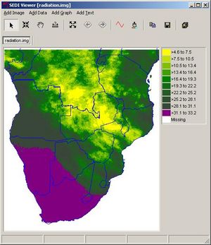
- Vector data in BNA format. This format has been developed by a company (Atlas GIS) for data exchange purposes. It is a simple ASCII format. The format allows the definition of points, lines and polygons, the three basic vector entities. See an example of a BNA File. Display a BNA vector file in Windisp unsing the File-Open-Map function:
Specifying the BNA file 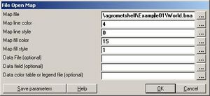
Displaying the boundary file in Windisp 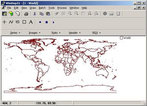
- FAO format. This format has been introduced by FAO to display data in columns and rows. See an example of a FAO format File. FAO format files can be displayed in an ASCII editor or more conveniently in Agrometshell with the View-Data-As columns function:
Specifying the FAO format file 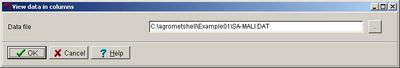
Displaying the FAO format file in AgrometShell 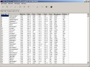 FAO format files can be edited in Excel or any other spreadsheet program reading Excel type files.
Opening the FAO format file in Excel 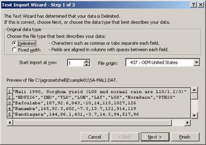
Specifying the delimiter 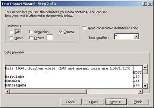
Editing the FAO format file in Excel 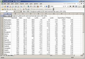 [edit]
GIS
In order to work effectively with large quantities of data the use of geographic information systems (GIS) is very helpful.
Geographic Information Systems (GIS) are computer programs that organize, display, and analyze spatially distributed data. At its simplest, GIS is "mapping", providing a geographic arrangement of extremely diverse information. GIS has been applied in geology, biology, psychology, anthropology etc., and has been around in Crop Forecasting for a long time.
General purpose GIS programs are designed to capture and analyze any kind of geographical data. The most common commercial GIS software packages worldwide are: ArcGIS and MapInfo
 Raster format
However the open-source community has created a wide range of free tools (to be downloaded from the internet). A nice start page can be found here: http://www.mapcruzin.com/free_gis.htm
[edit]Data
GIS data is commonly in one of two forms:
- Raster or image format. A grid of rows and columns of cells. These might represent photographic or scanned images. Within agrometeorology satellite images are usually represented in this way. Each cell represents a value. This value can be assigned a thematic colour in order to visualize the data. Raster data come in a large number of file types. A good overview of raster file types can be found here: http://data.geocomm.com/helpdesk/formats.html#raster-formats
 Vector format
- Vector format. Geometric shapes, including points, lines, and polygons. These might represent buildings, roads, and counties. This link gives sums up the most commonly used general purpose vector formats: http://data.geocomm.com/helpdesk/formats.html#vector-formats

| CM Box User Guide | Main Page | About | Special pages | Log in |
Printable version | Disclaimer | Privacy policy |


